Real Estate & Property Drone Photography
Aerial photos and video for homes, land, listings, exterior documentation, and property marketing. Serving real estate agents, property owners, homeowners, and property managers across southern Vermont, western Massachusetts, and southwest New Hampshire.
Homes with aerial photos can sell up to 68% faster.
Aerial photos help buyers understand the full property, setting, views, and surrounding features before they ever schedule a showing.
Source: NAR®, citing MLS data.
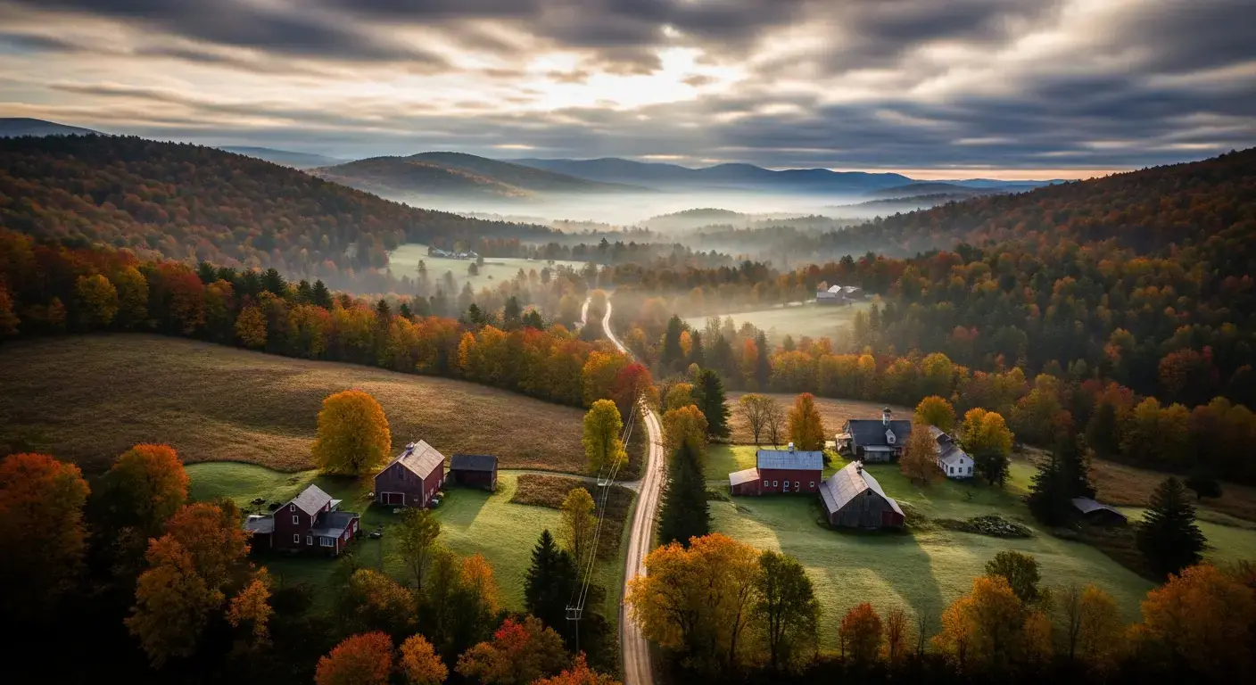
Show Buyers the Full Property
Ground-level photos show the house. Aerial media shows the setting, layout, curb appeal, land, driveway, neighborhood, and surroundings — the details buyers can't fully understand from the street.
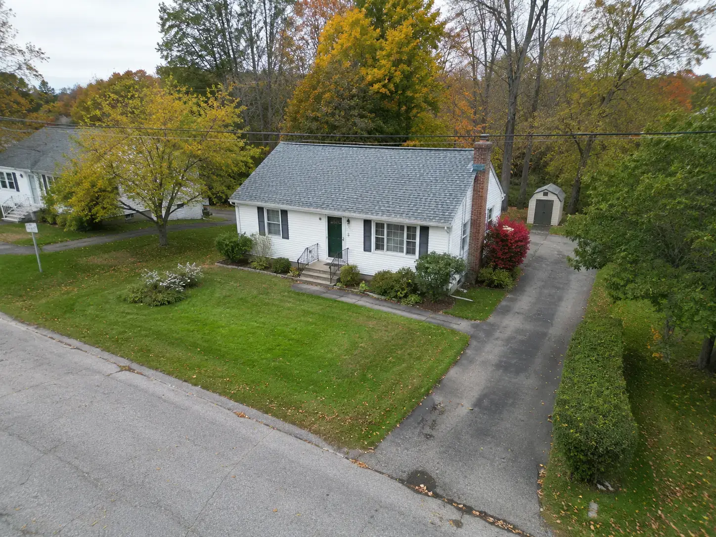
Make smaller listings look polished
Clean aerial views help starter homes and smaller properties feel more complete, professional, and ready for buyers online.
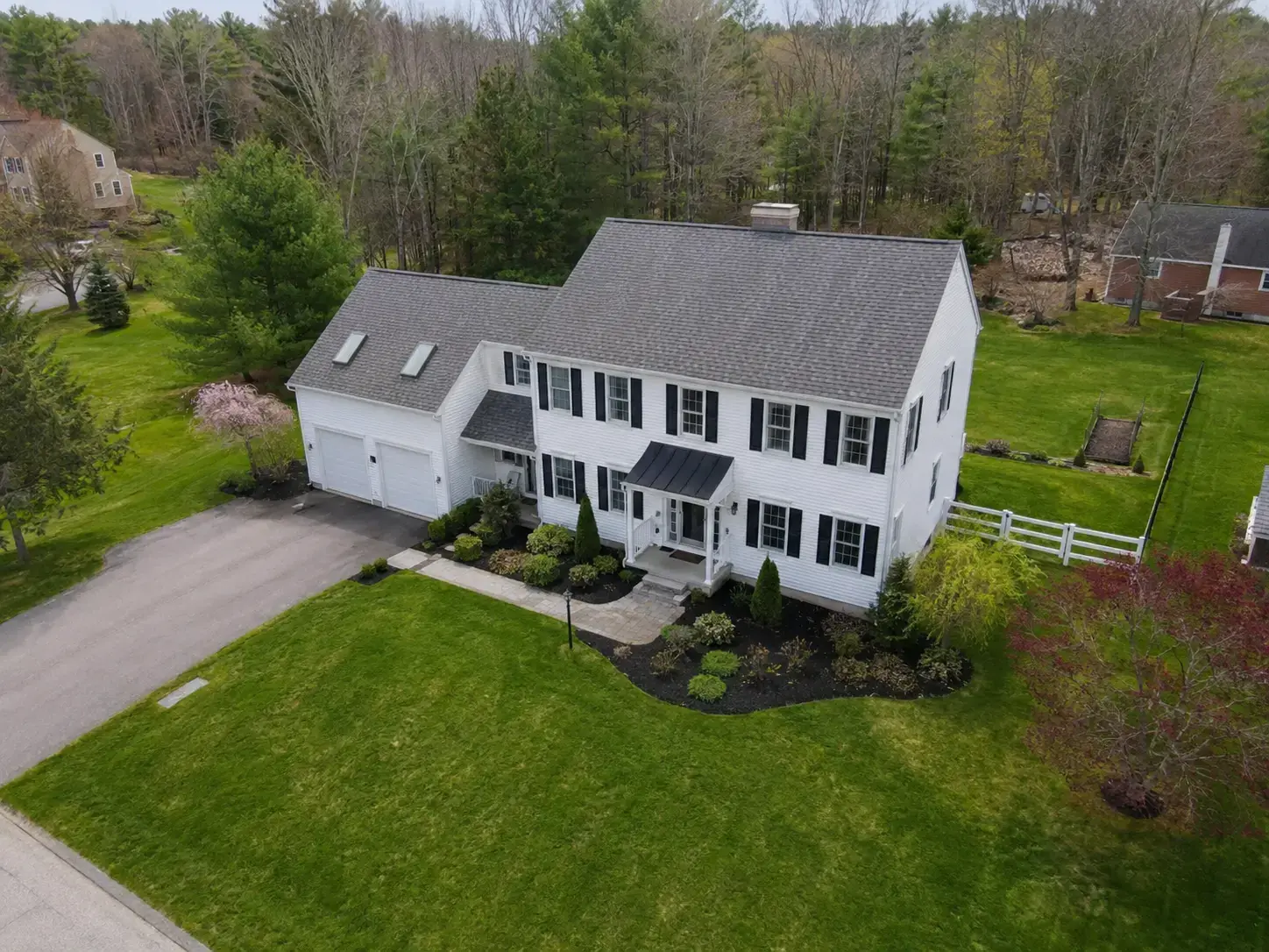
Show the layout buyers care about
Capture the driveway, yard, rooflines, landscaping, and surrounding property in one clear exterior view.
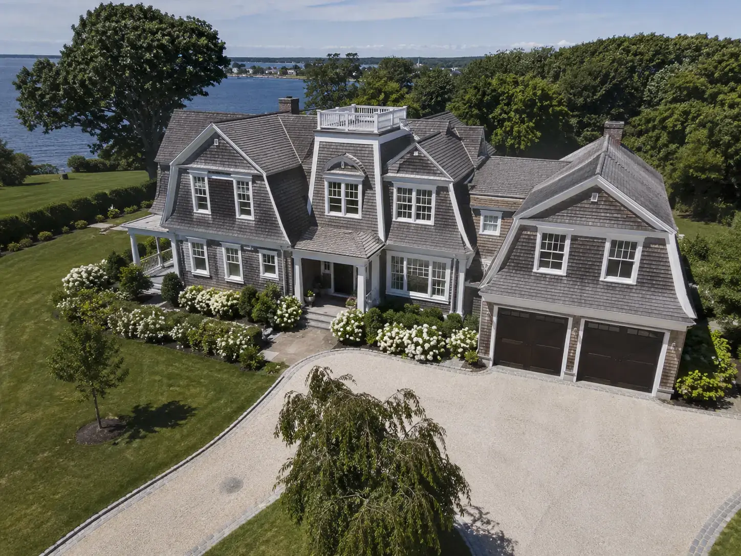
Match the quality of premium listings
Higher-value homes need elevated visuals that feel polished, intentional, and worthy of the listing price.
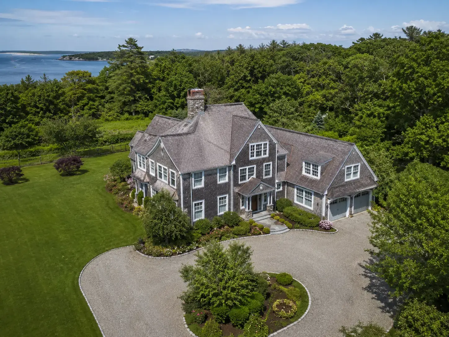
Sell the setting, not just the structure
For scenic, coastal, rural, or larger properties, aerial media helps buyers understand location, privacy, views, and lifestyle value.
Give buyers the full picture before they schedule a showing.
Get a QuoteWhy aerial property media matters
Most buyers start their search online, and listing photos often decide whether they click or keep scrolling. Drone visuals add context that ground-level photos cannot always show: the home, land, driveway access, rooflines, acreage, surrounding scenery, neighborhood feel, and overall curb appeal.
Common Project Types
Homes & Residential Listings
Aerial photos and short video clips that show the home, lot size, yard, neighborhood context, and surrounding landscape.
Land & Lots
Aerial views that clearly communicate acreage, topography, road access, and proximity to roads, water, or amenities.
Exterior Documentation
High-resolution exterior photos for property records, management files, insurance documentation, and marketing materials.
Also Available For
What You Receive
Depending on the project, deliverables typically include edited aerial photos, short aerial video clips, or both. Files are delivered digitally in formats suitable for MLS listings, Zillow, Realtor.com, property marketing sites, and social media. Both high-resolution stills and video are available.
Davis Drone serves real estate agents and property owners across Brattleboro VT, Bennington VT, Manchester VT, Windham County, western Massachusetts, and southwest New Hampshire. Turnaround expectations and MLS-ready file formats are discussed during quoting.
How a real estate shoot works
Send the details
Share the property address, listing date, and any specific angles or features you want highlighted.
I plan the shoot
I check airspace, weather, and sun position so the property is captured at the best time of day.
On-site shoot
A short, focused flight session — typically 30–60 minutes per property, weather permitting.
Edit and delivery
Edited MLS-ready photos and aerial clips delivered digitally in 48–72 hours.
Starting prices
Final pricing depends on property size, shot list, editing needs, and travel. These packages give most listings a clear starting point.
Listing Photo Package
From $249
Edited aerial photos of the home, lot, and surrounding property — ready for MLS, Zillow, brokerage sites, and social posts.
- 10–15 edited aerial photos
- Exterior home, lot, driveway, and surrounding property views
- MLS/web-ready image delivery
- Light color correction and editing
- Fast digital delivery
Photo + Aerial Video
From $399
A complete aerial listing package with edited photos plus short video clips for MLS, social media, and property marketing.
- 10–15 edited aerial photos
- Short aerial video clip
- Horizontal + vertical video versions
- MLS/web/social-ready delivery
- Light color correction and editing
- Fast digital delivery
Optional add-ons
Get a property media quote
Tell me about the listing or property — address, what you want to capture, and when you need it delivered. I'll get back to you within 1–2 business days.
Ready to make your listing stand out?
Give buyers a clearer view of the full property before they ever schedule a showing.
Get a Quote